In The History of the Hobbit John Rateliffe makes I think a very, very strong case that in the early phases of writing The Hobbit Tolkien placed it in the geography of Beleriand.* Mirkwood was Taur-nu-Fuin (indeed a translation thereof), the Great River was Sirion (which translates, in effect, as The River), and the Misty Mountains were the eastern Mountains of Shadow. Hobbiton accordingly lay somewhere in Hithlum, and leaving sheltered Hithlum meant entering "the Wild." One might also note Amon Ereb, "Mount Lonesome", which is on all the Silmarillion maps but plays no part in the legends; and the "Withered Heath" to the north "from whence come the Great Worms:" Dor-nu-Fauglith?
(It's also interesting that in all versions of the Beren and Lúthien story, after Thu/Sauron's defeat by Huan he takes up residence in- Taur-nu-Fuin).
However, T got stuck and left off working on Bilbo's adventures for a while, unsure of what to do next; this apparently came at the Beorn chapter. Plainly there was no room in the Silmarillion geography for Lake Town, the Lonely Mountain and its environs; and there wouldn't be any Elves of any sort, not even the Avari the wood-elves were originally conceived to be, in the grim forest on Dorthonion. (An alternative would be that Mirkwood was equated with Artanor > Doriath; but the rustic Elvenking and his rude caves certainly aren't lordly Thingol and wondrous Menegroth**, nor was Doriath ever black and evil).
(Before going on, it should be pointed out that at this time, the early Thirties, the Second and Third Ages did not yet exist. Númenor would enter with The Lost Road (1936); and the Third Age was created with the LR. And yes, I'm aware of the end of QN with its distant germ of the Last Alliance).
This is where things get interesting; evidence is sketchy and I claim no more than one possible interpretation: that Tolkien shifted his concept of The Hobbit's geography so that the Mountains were now the Ered Lindon; crossing into The Wild now meant leaving 'civilized Elvish' Beleriand and striking out into the blank spaces: "Here There Be Dragonnes." Moreover, I suggest, this conception still informed his earliest writing in The Lord of the Rings., which was, after all, supposed to be a Hobbit sequel.
The Ered Luin, remember, were called the Blue Mountains because of the bluish cast of the mists which shrouded them, rather like the Blue Ridge of the Appalachians and their neighbors to the south, the Smokey Mountains.
A great deal of this hypothesis, this 'Blue Mountains' phase if you will, keys on writings, contemporaneous with the early work on the LR, where Tolkien explicitly identifies Moria with ancient Nogrod: which along with Belegost had always been conceived as lying in the southern Ered Luin. In fact in an entry in the Etymologies Nogrod is translated (as should be plain) "Dwarf-delving;" of which Dwarrowdelf is merely an antiqued form. (Only much later did Tolkien cover his tracks and re-gloss Nogrod as "Hollowbold;" and the new Sindarin name for Moria, Hadhodrond, just substitutes "hadhod" (dwarf) for "naug" (dwarf), and restores the elided N in -rond 'cavern, vault.')
There is then a later note in which Nogrod-Moria, still the same place, has been physically moved hundreds of miles to the east into the Misty Mountains. This belongs naturally to the final geography; but illustrates the persistence of the identity of Moria with Nogrod, and the Longbeard Dwarves with the Indrafangs.
But back to the traces of this intermediate 'Blue Mountains' phase: remember that as Tolkien wrote what we know as Book I the geography was entirely vague; the regions between Hobbiton and Rivendell had not been mapped , and T never did successfully square Frodo's journey from Weathertop with what had been said of Bilbo- how on earth did it take Aragorn the Ranger many days to cover ground Thorin & Co. managed in a couple of hours? He tried to rewrite it in the Second Edition but it still doesn't really work.
Anyway, it's important to remember that during the writing of what Christopher Tolkien calls the "first phase," in which Bingo Bolger-Baggins and friends reach Rivendell with the help of Trotter the hobbit-ranger, the geography remained vague and fluid. In notes for what would become the beginning of Book Two, T envisioned the Company crossing the Mountains by the Red Pass***, turning southward along the River Redway, and only then entering Moria which lay "in the mountains of the south." These could of course be a separate range; but, again, Moria at the time was identical to ancient Nogrod, which lay in the southern part of the Ered Luin on their eastern side.
There is, I think, further confirmation if one compares the "Wilderland Map" of the Hobbit (especially the draft form published in Artist & Illustrator) with the (original) Silmarillion Map. The curves and the watercourses in the First Map's Misty Mountains are remarkably like those T had already drawn for his Mountains of Blue Mist in the Silmarillion. Moreover the world-map in the Ambarkanta, which is certainly later than The Hobbit, includes no north-south mountain range between the Blue Mountains in the west and the Red Moutains in the far east. (It's worth noting that, as first made, the Lord of the Rings Map contained nothing west of the Shire; that region, including the Ered Luin, was pasted on later.)
-----------------------
*Despite what T said in a letter many years later, TH *always* took place in the world of the Elvish legendarium; even the earliest drafts contain numerous references to things like the Three Kindreds, Gondolin, and even Beren and Lúthien However the time-frame, while vague, seems to be not long after the events of what would later be called the First Age).
** Which were already fully described in The Lay of Leithian of the late Twenties.
***Could Caradhras = Mt Dolmed?
The proto-geography of the Third Age
-
solicitr

- Posts: 3728
- Joined: Mon Apr 30, 2007 7:37 pm
- Location: Engineering a monarchist coup d'etat
The proto-geography of the Third Age
Last edited by solicitr on Tue Mar 31, 2009 4:13 pm, edited 2 times in total.
-
Voronwë the Faithful
- At the intersection of here and now
- Posts: 46134
- Joined: Mon Nov 21, 2005 1:41 am
- Contact:
Great post, soli. Really great.
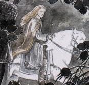
The only thing that I'll add at this time is that the drawing of Mirkwood that appeared in the first British edition of The Hobbit was actually based on a color drawing that Tolkien had done of Taur-nu-Fuin (for the scene where Beleg meets Flindor/Gwindor). That drawing, however, was then later recycled by Tolkien as "Fangorn Forest" for a 1974 calender (with Beleg and Gwindor becoming very tall versions of Merry and Pippin).
The only thing that I'll add at this time is that the drawing of Mirkwood that appeared in the first British edition of The Hobbit was actually based on a color drawing that Tolkien had done of Taur-nu-Fuin (for the scene where Beleg meets Flindor/Gwindor). That drawing, however, was then later recycled by Tolkien as "Fangorn Forest" for a 1974 calender (with Beleg and Gwindor becoming very tall versions of Merry and Pippin).
"Spirits in the shape of hawks and eagles flew ever to and from his halls; and their eyes could see to the depths of the seas, and pierce the hidden caverns beneath the world."

-
Primula Baggins
- Living in hope
- Posts: 40005
- Joined: Mon Nov 21, 2005 1:43 am
- Location: Sailing the luminiferous aether
- Contact:
Wonderful post, soli.
“There, peeping among the cloud-wrack above a dark tor high up in the mountains, Sam saw a white star twinkle for a while. The beauty of it smote his heart, as he looked up out of the forsaken land, and hope returned to him. For like a shaft, clear and cold, the thought pierced him that in the end the Shadow was only a small and passing thing: there was light and high beauty for ever beyond its reach.”
― J.R.R. Tolkien, The Return of the King
― J.R.R. Tolkien, The Return of the King
Sorry. I'm all compliments, too.solicitr wrote:Gosh, y'all are so nice.
But please bring on the criticisms! Can't we have a fight about it?
If there was anything that depressed him more than his own cynicism, it was that quite often it still wasn't as cynical as real life.
Terry Pratchett, Guards! Guards!
Terry Pratchett, Guards! Guards!
-
Voronwë the Faithful
- At the intersection of here and now
- Posts: 46134
- Joined: Mon Nov 21, 2005 1:41 am
- Contact:
I wish I knew how to say "your mother wears army boots" in neo-Sindarin. That would be so perfect.solicitr wrote:Gosh, y'all are so nice.
But please bring on the criticisms! Can't we have a fight about it?
"Spirits in the shape of hawks and eagles flew ever to and from his halls; and their eyes could see to the depths of the seas, and pierce the hidden caverns beneath the world."
-
ToshoftheWuffingas
- Posts: 1579
- Joined: Fri Dec 02, 2005 3:34 pm
What has fascinated and impressed me is how often Tolkien when seemingly stuck for inspiration, doubles up an episode, character or as you have shown here, a landscape. He then works wonderful magic on the duplication creating new perspectives, contrasts and echoes.
Thanks soli for one more insight into his creative process.
Thanks soli for one more insight into his creative process.
<a><img></a>
-
solicitr
- Posts: 3728
- Joined: Mon Apr 30, 2007 7:37 pm
- Location: Engineering a monarchist coup d'etat
Yeah, he does, doesn't he? The bridge over the river gorge into the great gates of a subterranean fortress-City: at Nargothrond, at Menegroth, and recycled in rustic form in The Hobbit. And yet each is itself, variations on a theme: so that both Felagund's and Thranduil's halls were inspired by Thingol's original. Same with Tirion-Gondolin and (very early) Kor- Kortirion (inspired by very real Warwick with its castle) and so on and on. What a fecund brain! With so many floriferous strands that, sure enough, the Quenya root talat was already there, waiting to take the form Atalante....What has fascinated and impressed me is how often Tolkien when seemingly stuck for inspiration, doubles up an episode, character or, a landscape.
Your wish is my command.Voronwë_the_Faithful wrote:I wish I knew how to say "your mother wears army boots" in neo-Sindarin. That would be so perfect.solicitr wrote:Gosh, y'all are so nice.
But please bring on the criticisms! Can't we have a fight about it?
MOTHER = naneth, nana or emil/emel. For a 'Yo mama' joke, nana would probably be most appropriate.
lín is the genitive "thy, your"
So, the first part is easy: nana lín
(I do not pretend to know about word order or lenition - I figure you only worry about that once you have all the words for your sentence assembled - but the 'pronoun' your does come after the noun in the examples I found.)
Sindarin vocabulary being limited as it is, I'm not sure I can make anyone wear something on their feet. Army is easy enough, of course.
thôl = "helmet" and dôl or dol = "head", so perhaps a word for "boot" could be extrapolated from a word for foot? After all, they look fairly similar in English
While I cannot find a verb that corresponds to "wear", hab- and hamma- mean "clothe". Slightly less helpful - doltha- means "conceal." So, if you don't mind concealing feet rather than wearing boots, I can maybe say it? Likewise, gleina- (or gleinia) means "bound, enclose, limit." pada- means to "walk"
hab- "clothe", inf. hebi, pr.t. hebi- (3 sg hâb), pa.t. hemmi- (3 sg hamp), fut. hebitha, imp. habo, part. habel (perfective hóbiel), pp. hammen (pl. hemmin), ger. habed
I think we want hammen or hemmin, since we are saying the mother "is clothed" rather than that she is clothing someone else. In other words, it's passive. I'll use the singular, since there's only one of her.
So far we have: Nana lín hammen - Your mother is clothed
But perhaps it should be "Your mother's feet are clothed," in which case it would be something like: I dail o nana lín hemmin
Aha! shoe ◈ habad It was glossed as "shore" in the other sources I checked, but apparently there's reason to suppose it means "shoe." And "military shoe" implies boot, anyway. Speaking of which, there are plenty of words with a military connotation, but not necessarily one that would best translate "army." So, I'll go with gwaith "troop of ablebodied men, host, regiment" (or even fellowship) rather than dagor "battle."
So, habad + gwaith.... *gets ready to pull hair out*
Definitely need the plural. Habad becomes hebaid (shoes) [it was hebeid in Nodorin, if anyone cares], while gwaith becomes gweith (hosts) - but will only be needed if we use it as an adjective, to match shoes. Making "gwaith" into an adjective is beyond my skill, but I could attempt it, I suppose: gweithen, or simply gweith
Maybe "shoes of the army" would be an appropriate combination? If so, we want: hebaid-en-gwaith. But it's probably easier to just say 'army-shoes' as a compound noun. gwaith+hebaid?
Lenition is needed for the second element of a compound (or for an adjective following a noun), but nasal mutation does not kick in with "en", I don't think (and would have no effect on gw- anyway). For soft mutations, gwaith would become 'waith, and hebaid would become chebaid.
So, hebaid-en-gwaith, gwaithchebaid, or hebaid 'weith(en) are the choices.
vi = in. vin = in the I am assuming the army boots are generic, not a specific pair. na = with, if you think that's more appropriate, but that would trigger lenition, so I'm going with vi instead
Nana lín hammen vi hebaid 'weithen.
Which translates roughly as: Your mama is clothed in host-shoes.
I do not pretend to know enough Sindarin to vouch for this translation - it is extremely hypothetical. Consider it...a starting point.
Sources: Ardalambion
English-to-Sindarin: http://www.uib.no/people/hnohf/parviphith.doc (Word doc)
Sindarin dictionary: http://www.jrrvf.com/hisweloke/sindar/o ... sd-en.html
Conjugation of Sindarin verbs: http://folk.uib.no/hnohf/sindverb.htm
-
ToshoftheWuffingas
- Posts: 1579
- Joined: Fri Dec 02, 2005 3:34 pm